This post may contain affiliate links.
Maybe you’re better than us about this, but James and I tend to put a lot of trust in our GPS. If we were less lazy, we’d take the time to actually check the route Google maps picks for our travels. But we’ve only been burned by our GPS a few times, and only in minor ways, so it’s never really been an issue. We can usually punch in our destinations and trust we’ll get there as uneventfully as possible. Until! We plugged in our Lost Coast campground.
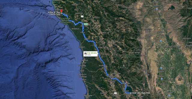
Our Google maps route… dun dun dun DUN
Before I start, allow me to catch you up. Last time I recapped, we were at Clear Lake State Park being swooned by pelicans and scenery and a park all to ourselves. We’d been in the RV a couple weeks by then, and we’d gotten used to the rhythm of RV life—you know, things like lightning-fast showers, cooking outside, and no bedroom door to protect us from a cat headbutting our faces at 4am.
So now let’s pick up the story from there. The drive from Clear Lake to our next campground, AW Way County Park, was (supposed to be) well under 4 hours and we couldn’t wait. Finally, FINALLY we were headed to do a bucket list adventure… exploring and biking NorCal’s Lost Coast.
California’s Lost Coast is the most remote stretch of coastline in the Lower 48. It’s the section that forced Route 1 to bend away from the shore and head inland to meet with the 101. The enormous and steep coastal mountains in the Lost Coast area plunge so sharply into the sea that the only sensical thing for roadmakers way back when to do was to build the main roads around.
Lost Coast pic from maplogs.com looking out to the ocean…
Fast forward to today, and with no major roads passing through, the Lost Coast remains wild and rugged and is minimally inhabited. There are a few tiny hamlets far from civilization like Shelter Cove and Petrolia with populations in the 100s, and then smatterings of private ranches hidden between stretches of beautiful, undeveloped forests. With the heavy smell of pot in the air, it wasn’t hard to guess what was growing just out of sight. But we certainly didn’t go investigating.
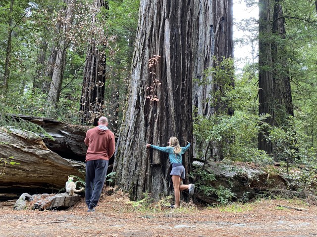
When I was planning our itinerary of fun a month earlier, Google had showed me we’d enter the Lost Coast area by taking the 101 north and then turning west to follow Mattole Rd through Humboldt Redwoods State Park. This had me even more jazzed. The California redwoods are one of our favorite places on Earth. Google wants us to drive through them to start our bucket list adventure?! Pinch me. How perfect.
So, when it was finally time to head to the Lost Coast, we punched in the address for our campground. To the Lost Coast or bust! Bucket list adventure, here we come!
It didn’t dawn on us when the GPS had us turn off the 101 at Garberville and onto some rugged narrow remote mountain road, that we weren’t headed for the Humboldt redwoods as we thought. Since there were huge redwoods all around us and we were expecting redwoods, we didn’t question it. Then the road got more windy and challenging, and something felt off. A quick check of the map since I still had one bar of service—the last of the cell service we’d have for 3 days— was when I confirmed Google had us bypassing Humboldt Redwoods and coming into the campground a different way. Well, we were this far in already… so we chalked it up as part of the adventure and we forged on. The GPS said we’d have 90 more minutes of this. So, in RV speak, that probably means… 3 hours?
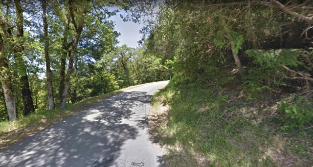
A Google maps view of a random section of the road. Pretty, but challenging!
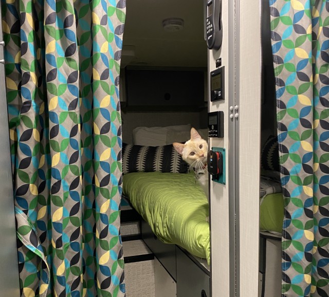
Calling this a road is a very generous way to put it. Not only were there sharp curves and insanely steep grades, it was also comically bumpy and potholey. Sure, it was “paved”, but in such disrepair, some sections had been given up on and were replaced with gravel. The road would often narrow to a single lane, which was especially harrowing right along a steep mountain dropoff, where you prayed you wouldn’t meet another car. With our speed averaging around 10mph, I kept a death-grip on the door with my right hand and held on to Mel, the little scaredy-cat on my lap, with my left.
I consoled myself that at least I was getting a good abs workout. Over one especially bumpy section James said, “I can just feel all my mods slowly coming undone back there…”
The sun set about 30 minutes in, and we were driving in the dark. Oh good! A terrifying road AND nightfall! Why not throw in some more gravel and REALLY make this festive! It was almost Halloween after all.
Sure enough, more gravel came. Almost two hours in, we hit the most challenging stretch of road we’ve ever driven in an RV. We had just done a long climb up one of the mountains and were heading down the other side. Suddenly the steep 18% grades we were growing used to got even crazier… with what felt like 25-30%. AND! It had now turned to gravel. Zoinks!
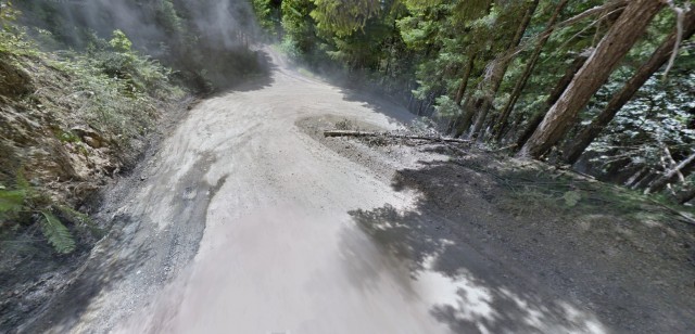
Another Google maps view. Is this really a road or is it a wildlife path?
So, there we were, looking down Mount Everest, both of us not sure Number One would be able to take the steepness or if we’d end up sliding and tumbling down the side of the mountain lost to the Lost Coast in some sort of morbidly funny but not funny play on words death scene. I’m happy to report, we lived. But not without more door-gripping and “oh my god oh my god we’re going to die” “Stef you’re not helping” conversations as we drove our way vertically down the side of a mountain.
We arrived at the AW Way County Campground after 2+ hours on those crazy back roads in one piece. Well, physically in one piece at least. It was dark, but we were happy to see only two other parties seemed to be in the campground, yay! We pulled in as far from both of them as we could get.
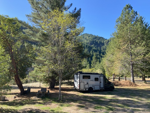
Because that’s what you do, right? It’s sort of unwritten code between campers in remote places. Spread out and give everyone their own space. It’s like walking into a public restroom with a long line of toilets, and only one other person in there who is way down at the far end. You don’t choose the stall right next to them, right? That’s weird! So, when remote camping, remember the toilet code. And apply that as you pick your campsite, too.
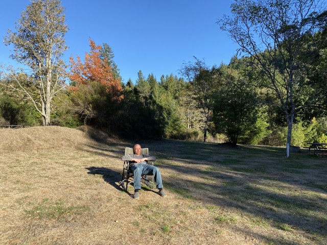
…James models following the campground code. No infringing on space! Good job, James!
It wasn’t until the next morning that we were able to see the campground was as lovely as it appeared online; perhaps even more so. There are no hookups and no dump station, but that was fine with us. We prefer more natural settings. Adding to the nature-is-cool vibe, the campground is right along a river, so whenever you’re outside, you can hear the sounds of water flowing.
Look at me! I’m in nature!
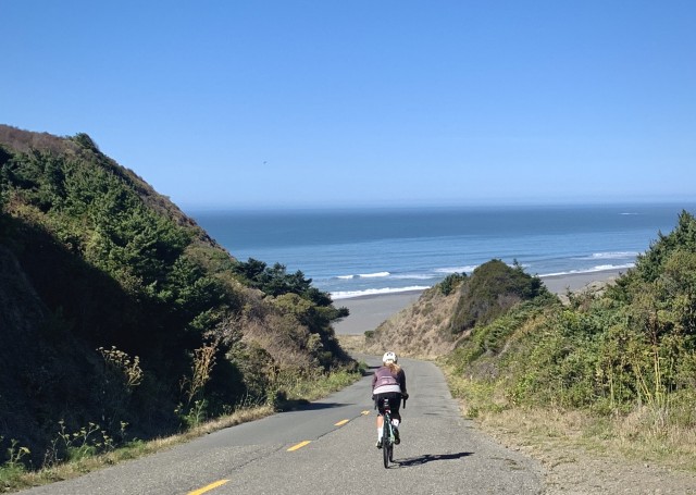
The Lost Coast wasn’t on our bucket list because we simply wanted to GO there. None of our trips are ever just about going somewhere. For the Lost Coast, it was on our bucket list because we wanted to bike it.
I forgot my riding glasses and had to rough it with these instead! I forget something every trip, I swear.
Biking the Lost Coast tends to find its way on the Most-Epic-Rides-in-California lists on many, many websites. Some even call it out as the best ride in all of California. So with endorsements like that, how could we NOT bucket list it?
The morning after the drive of terror, James griddled us up a big heavy campsite breakfast… the kind that makes you feel so full and gluttonous that you can’t wait to work it all off with some hard exercise.
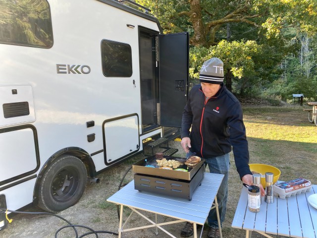
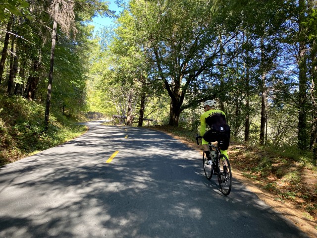
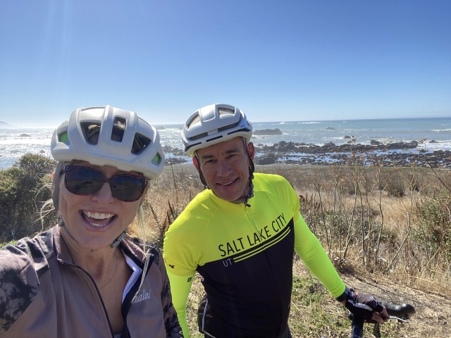
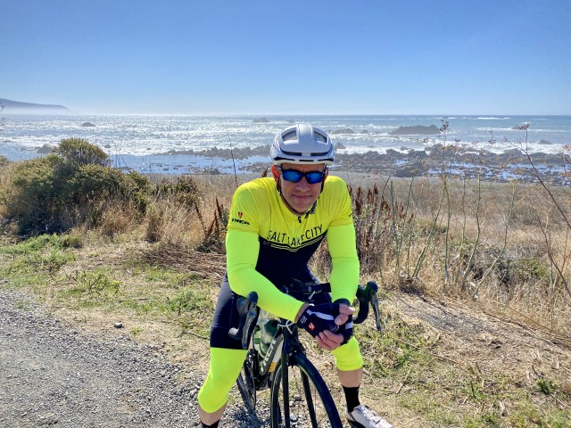
After doubling our bodyweight in griddle breakfast, we kitted up and hit the road. Weather can make or break a bike ride, but we got lucky this time. Sunshine and mid-60’s. A perfect fall riding day. Weather like this is unusual for the area. Summers in the Lost Coast tend to be foggy, grey, and chilly… and here we are in October with sunshine and warmth! Perhaps Mother Nature was feeling bad for us after our drive of terror the night before, who knows, but it was certainly a treat not to have to wear the winter riding gear we had packed.
I learned something as we biked our way to the ocean from our campground. Remember the road of terror we drove in on? Turns out it wasn’t an exception. ALL the roads around the Lost Coast were just like that one.
This bike ride was HARD.
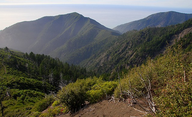
We were either climbing up steep mountains or coasting down. And don’t think the downhills were any easier. With the roads in such disrepair, you couldn’t just open up and fly down them since you never knew if there were potholes being camoflauged in the tree shadows up ahead. I remember climbing up one particularly death-defying gravel patch which was around 20% grade, so steep both our wheels started spinning out. We couldn’t get traction! I’m not sure how we stayed upright, but I’ve never experienced anything like that on a road ride. Really, it would have been smarter to ride it on mountain bikes.
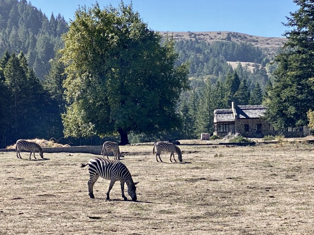
But don’t get me wrong. This ride was AWESOME! Breathtaking scenery, rarely a car, and the crazy steepness and twists and turns made it like no ride we’ve ever done before. We even spotted zebras!!!
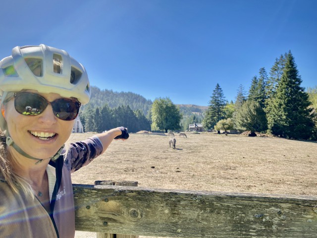
Talk about random and out of place finds! As we were biking by, it took me a moment to make sure I was seeing right. James didn’t even notice them, I had to call out to him to stop. Here’s a closer look to prove it. They really were zebras!!!
Zebras weren’t the only animals we spotted:
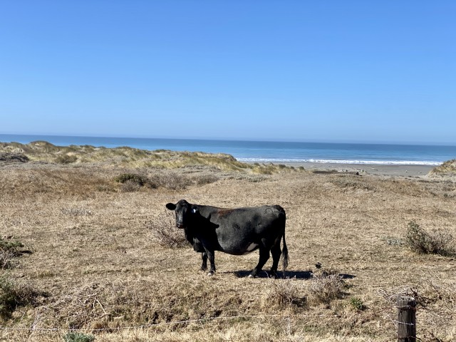
This cow’s home has better views than ours!
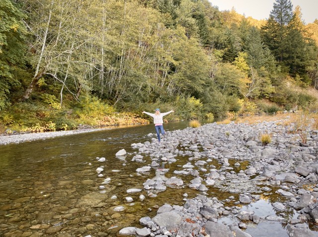
When we finally got to the ocean, I had James hold my bike as I whipped my shoes off and ran around in the surf. Because, a beach all to myself?! How often does THAT happen?
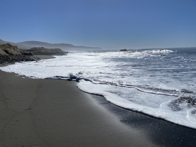
As I stood there on that beach, splashing around like a 10 year old, I couldn’t help but marvel about how lucky I was to just be there in that moment. That beach was all mine. Well, mine and the cow’s. I tried to get James to join me down by the water but no-go. Sand and James are mortal enemies.
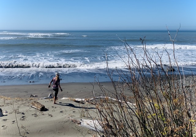
I’m sure the idea of biking on with sand between his toes sent his OCD-radar beeping on red alert. So I didn’t push it.
We got back to the campground while it was still light, and on a total high from our day of Lost Coast riding (or perhaps that was the strong smell of pot on the air).
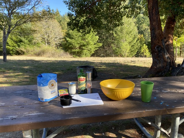
We had absolutely no cell service during the few days we spent in the Lost Coast, and that was a well-needed disconnect respite for us both. We used our time in other ways, like making pizza crust… with views!
When it was time to roll out of the Lost Coast and head back towards civilization, we made sure we checked that the GPS was taking us the more direct way out.
Because that’s the thing about traveling. It always, ALWAYS, comes with challenges along the way. So you learn from them and adjust. It’s the journey’s unplanned issues that help you gain new perspective and allow you to think about things differently. I know I just complained a whole lot about the Lost Coast roads and the hard bike ride. But I wouldn’t change a thing. Getting pushed outside our comfort zones lets us test ourselves and see what we’re made of. I love that about travel. Feeling like I’m leaving the place a little more in tune with who I am.
So! If you’re up for the adventure of the Lost Coast, consider yourself warned. It won’t be easy, but it’s a trip you won’t ever forget. ❤️


That trip sounds amazing and I totally want to do it, now! Except, we’ll bring gravel bikes for sure. I loved this post, thank you so much for the inspiration.
Gravel bikes would be much more appropriate, indeed! 🙂
I recommend King Arthur’s Neapolitan-Style “00” Pizza Flour. Also, for the best crust, you have to let it rise overnight, You have to let the gluten develop to get that chewy, crisp texture. BTW, we are EKKO gonnabe’s who, like you, cycle and ski (but mostly rock climb.) We love seeing the mods you’re making to your EKKO.
I really need to try that flour; seems like it’s my missing link! Sounds like as active as you are, the EKKO will be a great fit. We’re loving ours; hope you will, too! 🙂
Enjoyed your Lost Coast article. A question on the roads traveled…if one were to enter and exit the Lost Coast through Ferndale would that eliminate the worst portion of the poor roads? We have a 24′ 3500 Sprinter B with duals but no 4wd and were wondering if in an out this way would be easier?
The roads are no better than coming in at Humboldt Redwoods State Park. But you’ll have no trouble in your Sprinter either way, just go slow! Do keep an eye on your GPS, if you’re coming in from the south and you see your GPS is trying to have you turn off the 101 at Garberville and enter that way… don’t do it! Make sure you don’t turn off until Humboldt Redwoods and you’ll be fine. Hope you have an awesome trip!
Reminds me of a family trip in 2013 where my son on his new iPhone with the brand new Apple Maps plugged in Multnomah Falls in the Columbia Gorge to route find. In about 15 minutes we were on a death defying mountain one lane gravel road looking at tree tops on the downside side of the slope. We drove for about 30 minute before we came to two driveways — with large signs warning of the man-eating dogs — and a third road big enuf to turn around.
We realized at the point, that the phone was trying to bring us to the top of Multnomah Falls. Not the bottom where are the normal folk go.
So turned around and coasted on the transmission all the way back down, and in the process cracked it, so that were were leaking tranny fluid all the way back to MI. Alas, another great adventure in the late life of our old van.
Multnomah Falls is nice, BTW. Looking UP at it…
YIKES! Hopefully enough time has passed that you and your fam can now laugh at that misadventure!
Have taken several trips to Cali. For now I won’t. I refuse to have to show a Vaccine Card. (yes I have IT) it just seems so un-American.
Hello Stephany—Enjoyed your one-on-one kind of story. My favorite kind. Having done what you are doing in the past, and being a friend of Humboldt county I was delighted to travel step by step with you up-up-up and down–down-down too. Though it has it’s “ups and downs” it is a one of kind place thanks for taking me back to those days of yesteryear of the 80’s and 90’s for me. Don’t miss the bath tub beach race every summer on Petrolia Beach. Bill
Bath tub beach race?!?!? Well now I have something new to add to my bucket list!
Oh you poor puppies, putting your trust in IT nerds who live in virtual space more than the physical world (Google Maps). I don’t know what is wrong at Google these days but little seems to be ground-checked. For an adventure like this Ride with GPS (rwgps.com) is a better resource for plotting and navigating. It gives easy access to OSM (Open Street Maps) which are crowd-sourced and tend to be up to date, plus USGS topo maps. The elevation plot would have alerted you to the 15%+ grades.
Anyway, now you have a good story!
Thumbs up on the King Arthur Flour!
LOL, King Arthur is the bomb! And yes, Ride with GPS is one of the best ways to find rides, besides Garmin’s heat map… which also lets us build our own custom routes right over the heat map and then download the route into our Garmins.
The Lost Coast is all over Ride with GPS! We knew what we were getting into, but it didn’t make it any easier! Here’s a Ride with GPS Lost Coast example: https://ridewithgps.com/routes/5471806